The El Niño Southern Oscillation (ENSO) is one of the most important climate phenomena on Earth due to its ability to alter atmospheric circulation globally, influencing temperature and rainfall in many countries. It is closely observed by the agricultural industry as it shifts the probability of experiencing certain weather outcomes, which can be understood months in advance. Agencies around the world monitor sea temperatures and atmospheric conditions in the Pacific Ocean to inform of ENSO events.
After 3 years of an unusually stubborn La Nina, there is now a likelihood that El Niño will develop later this year, according to a new update from the World Meteorological Organization (WMO). El Nino would have the opposite [RP1] impacts to La Nina on weather and climate patterns in many regions of the world and would likely fuel higher global temperatures.
The ENSO Outlook remains at El Niño WATCH, which means that the El Niño–Southern Oscillation (ENSO) is currently neutral. The National Oceanic and Atmospheric Administration (NOAA) most recent update suggests a 62 per cent chance of El Nino developing during May-July 2023”.
WHAT CAUSES EL NIÑO?
An El Niño occurs when sea surface temperatures in the central and eastern tropical Pacific Ocean become substantially warmer than average, resulting in a shift in atmospheric circulation.
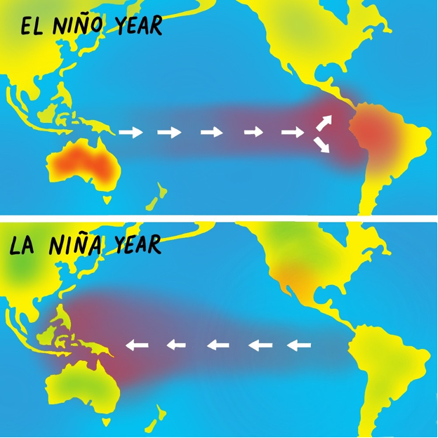
Warming of ocean temperatures in the central and eastern Pacific causes this area to become more favourable for tropical rainfall and cloud development. As a result, the heavy rainfall that usually occurs to the north of Australia moves to the central and eastern parts of the Pacific.
Normally equatorial trade winds blow from east to west across the Pacific Ocean, however in El Niño years there is often a weakening, or even reversal, of the prevailing trade winds.
IMPACTS OF EL NINO
Reduced rainfall
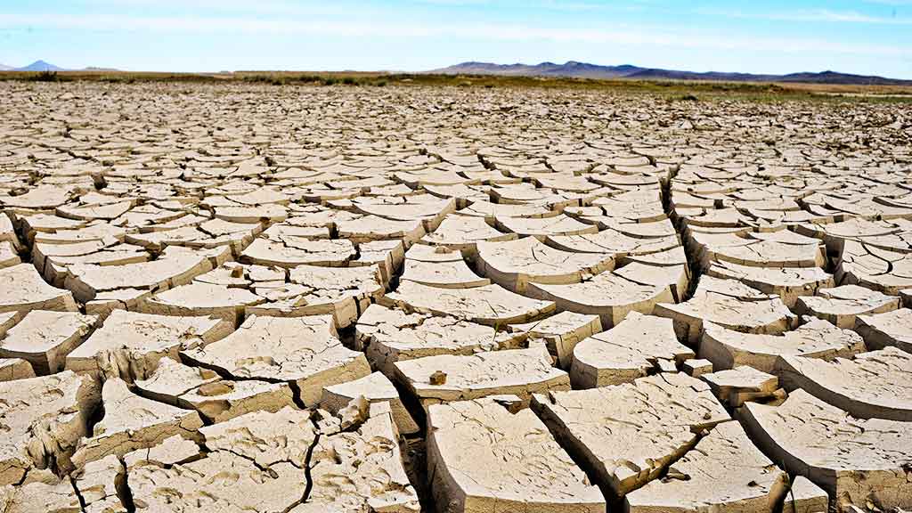
With El Nino causing a shift in rainfall away from the western Pacific, Australian rainfall is typically reduced through winter and spring, particularly across the eastern seaboard and northern parts of the continent.
Warmer temperatures
El Niño years tend to see warmer-than-average temperatures across most of southern Australia, particularly during the second half of the year. In general, decreased cloud cover results in warmer-than-average daytime temperatures, particularly in the spring and summer months. Higher temperatures exacerbate the effect of lower rainfall by increasing evaporative demand.
Shift in temperature extremes
During the warmer half of the year, there is a tendency for weather systems to be more mobile during El Niño years, with fewer stationary high pressure systems. For southern coastal locations such as Adelaide and Melbourne, individual daily heat extremes tend to be of greater intensity (hotter) during El Niño years but there is a reduced frequency of prolonged warm spells. Further north, El Niño is associated with both an increase in individual extreme hot days and multi-day warm spells.
Increased frost risk
Although maximum temperatures are generally warmer than average during El Niño years, decreased cloud cover often leads to cooler-than-average night-time temperatures during winter–spring, particularly across eastern Australia. Frost days that occur in Spring months can have a seriously detrimental effect on Agriculture as it impacts the plant growing season.
Increased fire danger in southeast Australia
As a result of decreased rainfall and increased maximum temperatures, the frequency of high fire danger ratings and risk of a significant fire danger season in southeast Australia are significantly higher following an El Niño year, particularly when combined with a positive Indian Ocean Dipole (IOD) event.
IMPACT OF EL NIÑO ON AUSTRALIAN AGRICULTURE
El Nino typically suppresses rainfall in eastern Australia during the winter and spring months. Drier-than-average weather conditions are of particular concern, as water deficits could curtail both plantings and yields with compounding negative impacts on final production.
Further to this, climate models forecast a shift to a positive Indian Ocean Dipole which can suppress winter and spring rainfall over much of Northern and Eastern Australia and potentially exacerbate the drying effect of El Nino. Given the vast majority of Australia’s pulses, milling wheat and barley are grown in eastern Australia, this may lead to a significant reduction in yields for the 23/24 season
Ameliorating impact of El Nino
In years where El Nino is present, farming is one of the most heavily impacted industries. A reduction in available water, temperature increases, multiple heat days and increased frost risk all provide significant challenges to growing seasons for a range of important cereal and horticultural crops. Resulting reduction in yields then creates a significant economic loss for the country.
Measures such as Agricultural R&D and developing water and temperature resilient crops are becoming more important. Further identification of regions most susceptible to El Niño effects will also support preparedness and response planning to minimize the negative impacts on agriculture and food security.